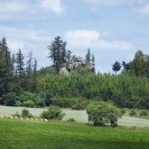
Bzí and Radkovice u Měčína, Plzeň-South dist. and Klatovy dist., Plzeň Region
Hill-top settlements of the Middle Eneolithic
(3100–2800 BC)
Two Middle Eneolithic Cham Culture settlements with a peculiar location on smaller rock outcrops in west Bohemia. The hilltop sites were probably occupied by a single family or small community. Amateur archaeologist F. X. Franc conducted an excavation at ‘Velká Skála’ near Bzí at the end of the 19th century, though in a very sophisticated manner: he studied, for example, raw materials for the production of stone tools, and the imprints of cereal grains on pottery. The second site on ‘Osobovská skála’ near Radkovice was discovered relatively recently and the excavations confirmed the agricultural character of the settlement.
References: Franc 1906; John 2007, 2010.
Navigation points: N 49°32'30.08", E 13°28'56.76" (Bzí); N 49°28'47.62", E 13°27'34.32" (Radkovice u Měčína).
Map notes: B–F – ‘Velká Skála’ near Bzí, G–J – ‘Osobovská Skála‘ near Radkovice. B – locations of dwellings and large concentrations of archaeological finds; C – tilted plateau where remains of three house were discovered; D, F – concentrations of finds; G – a plateau on which a dwelling probably stood; H–J – archaeological trenches. Map symbols are available in the Downloads section.
Selected fulltext articles and reports for further reading. Complete bibliographical records are available in the Downloads section as the List of publications.
Archeologický atlas Čech – Bzí and Radkovice u MěčínaJohn, J. 2007: Zpráva o výzkumu suťových situací na eneolitické výšinné lokalitě Osobovská skála (k. ú. Radkovice u Měčína, okr. Klatovy). In: P. Krištuf – L. Šmejda – P. Vařeka (ed.), Opomíjená archeologie 2005–2006, Plzeň: Katedra archeologie FF ZČU, 110–115.


